Cloudy, 34° F
Aiming to address concerns raised by property owners, Park County commissioners and Planning and Zoning board members have made several changes to the county’s proposed land use plan.
A …
This item is available in full to subscribers.
The Powell Tribune has expanded its online content. To continue reading, you will need to either log in to your subscriber account, or purchase a subscription.
If you are a current print subscriber, you can set up a free web account by clicking here.
If you already have a web account, but need to reset it, you can do so by clicking here.
If you would like to purchase a subscription click here.
Please log in to continue |
|
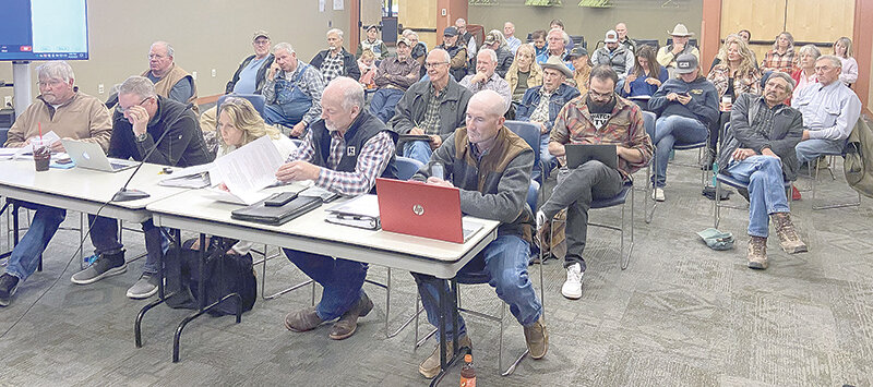
Aiming to address concerns raised by property owners, Park County commissioners and Planning and Zoning board members have made several changes to the county’s proposed land use plan.
A few dozen residents critiqued the document at an early October meeting and the changes approved Tuesday came in response to some of their main concerns, which generally surrounded protecting private property rights.
For example, on a page early in the plan, a stated goal of “Balancing private property rights with the needs of the community and the environment” was replaced with a goal to “Support private property rights while addressing the needs of the community and environment.”
The commissioners and board members also modified the plan’s agricultural and big game overlays and wording related to 20-acre minimum lot sizes.
The board previously agreed to change the big game overlay to a wildlife overlay, but reverted back to big game on Tuesday, because the data in the maps specifically measured pronghorn, deer and elk migration.
Commission Chair Dossie Overfield said the overlay’s language has also been modified to make clear that “it’s not regulation.”
“It’s just a little more scrutiny in those areas,” she said.
A big change involved eliminating the medium and low density big game overlay zones, leaving only about 11,000 acres of private land included in the high density
portion of the county’s map. That was intended as a compromise, though some members still worried about having a tool in the land use plan that could lead to more scrutiny.
“We are definitely headed down the scope with restricting private property with wildlife,” P&Z member Brian Peters said. “If we’re leaving this map in ... I would want it pushed back as far as possible.”
The idea of only applying the overlay to areas with high amounts of wildlife wound up winning general agreement from the group.
"I stick with high just because that’s what they consider crucial,” said Commissioner Lloyd Thiel. “That’s what we’re really after.”
The majority of the county officials also agreed to keep the big game overlay rather than just putting it in the plan’s intro and separating it from the regulations.
“The folks that want to protect wildlife ... who want to ask someone to do something with their land to make it more habitat, wildlife friendly, there’s got to be more skin in the game," Commissioner Lee Livingston said, adding that he would be against it being a regulation. "If you put in an overlay, it makes funding more available ... You get a higher ranking if applying for funding, getting conservation easements. I want folks to look at what they're doing with their land, consider what’s happening because of wildlife."
P&Z chair Kimberly Brandon-Wintermote favored keeping the overlays and noted current rules prevent the boards from denying a development because of an overlay.
Most board members agreed with her, with Peters saying if it did stay in, just having the high use in there was the next best thing.
Overfield noted that certain planning areas were very much in favor of more scrutiny on developments in wildlife-heavy areas, such as the South Fork, North Fork and Sunlight Basin. Overall, county consultant Clarion found nearly 51% of residents wanted a proactive approach to the big game overlay, while only 26% favored a limited approach.
Most of the other changes made on Tuesday were closer to typos than major shifts. For example, they adjusted wording to ensure it could not be misconstrued to say the land use plan will be anything more than guidance.
Concern about language related to 20-acre minimum lot size averages being recommended in many rural areas popped up again as well. Most board members agreed with language that’s already in the ag overlay, which says to encourage conservation of larger tracts of land but allow smaller lot sizes in conjunction with land use guidelines.
Board member Duncan Bonine had objected to wording throughout a section of the land use plan that suggests 20-acre minimum acreage sizes in rural areas with exceptions. He said in an area like Cody Local especially, that wording shouldn’t be there.
Bonine said the ag overlay already provides enough guidance on working toward larger lot sizes in heavy ag areas.
"Everyone wants to help our ag producers, let’s don't create a rule that requires more regulation,” he said.
Overfield said she would go back to Clarion to determine which areas truly wanted to encourage the 20-acre-plus lot sizes.
County Planning and Zoning Director Joy Hill said the map in the plan is intentionally vague, while the regulations and zoning maps in the future will be much more specific.
"The future land use map was born of the land suitability map ... it’s generalized,” Hill said, adding “We recognize within that area there's land more or less suitable."
She said the county will drill down when it begins discussing regulations, but "you need somewhere to start."
The revisions requested by the two boards will be sent to Clarion for changes. The plan will then be subject to a 30-day public comment period before being brought back to P&Z. After that board signs off on the plan, another 45-day public comment will follow before it goes back before the county commissioners for final approval.


