, 52° F
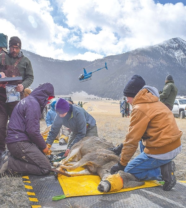
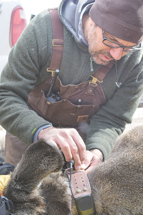
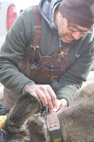
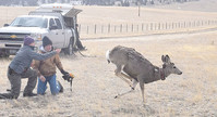
Ninety mule deer were captured and fitted with real-time GPS collars that transmit data to researchers every three days. It is a mapping project to document migration corridors of five separate herds near Cody, Meeteetse, Dubois and Lander.
On …
This item is available in full to subscribers.
The Powell Tribune has expanded its online content. To continue reading, you will need to either log in to your subscriber account, or purchase a subscription.
If you are a current print subscriber, you can set up a free web account by clicking here.
If you already have a web account, but need to reset it, you can do so by clicking here.
If you would like to purchase a subscription click here.
Please log in to continue |
|


90 mule deer captured and fitted with GPS collars
They couldn’t tune into Taylor Swift, but the radio collars mule deer are now sporting will help scientists track their migration corridors across the eastern region of the Greater Yellowstone Ecosystem (GYE).
Ninety mule deer were captured and fitted with real-time GPS collars that transmit data to researchers every three days. It is a mapping project to document migration corridors of five separate herds near Cody, Meeteetse, Dubois and Lander.
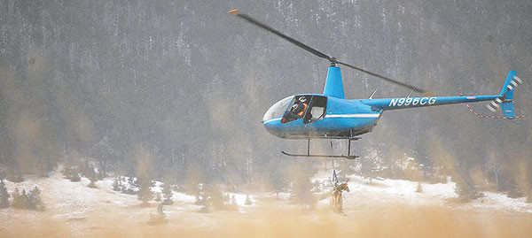
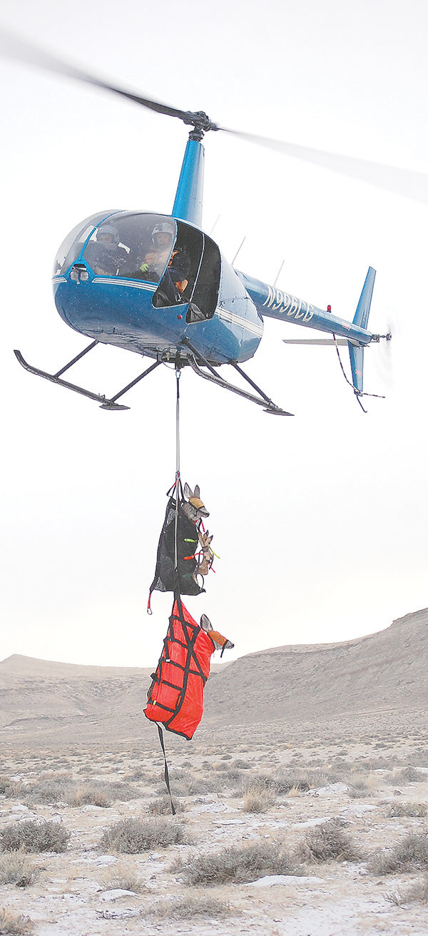
On Thursday, Wyoming Migration Initiative personnel took their operation to the Sunlight Basin/Heart Mountain area north of Cody.
“We’re going to try to do 30 (deer) today,” said Gregory Nickerson, who was photographing the capture for the Initiative. “We’ll wrap up the 90 deer.”
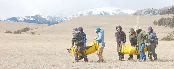
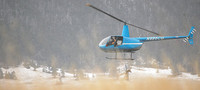
Snow is falling and the wind is freezing as the helicopter ratchets in spinning snow like a crystallized monsoon. Two mule deer, wearing blinders and wrapped in tarps dangling from the helo’s underbelly, are deposited light as feathers on the snowy turf. Immediately two teams of biologists and volunteers race out to fetch their hoofed patients. Like EMTs, they carry the deer in the makeshift stretchers to medical equipment sheltered by pickup trucks and trailers.
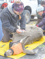
“Seventy-eight over 107,” said one biologist to his colleague logging vitals on a clipboard.
They examine muscle thickness to calculate fat reserves to determine how the doe is faring during the hungry months of winter. Stool samples are taken to ascertain diet.
Then, an ultrasound to check for pregnancy.
To the untrained eye, the sonograph’s image approximates gray apparitions floating in clouds illuminated by distant lightning. It’s incredible to observe medical technology in the field; to witness the miracle of life.
“You can see the flutter of its heartbeat,” said the scientist. “It just moved its head,” he said tracing his finger over the captivating image. “That’s the spine.”
Triplets
“I think most of them have been pregnant,” said Matthew Kauffman, Wyoming Migration Initiative director and zoology professor at the University of Wyoming.
One doe was carrying triplets. “It’s fairly uncommon,” Kauffman said. “We’ve only seen it in a few deer.”
The focal point isn’t necessarily pregnant muleys, but they are certainly central to the study. And, bucks will likely travel similar routes.
“The focus of this study is identifying the migration corridors of these herds,” Kauffman said. “It will allow us to map their migration corridors.”
Of the 90 radio-collared does caught and released on Thursday and Friday, 22 were from the Sunlight Basin area, one from Heart Mountain and seven from the North Fork of the Shoshone River, Kauffman said.
Data update
“The data won’t be available until the study is done in three years,” Kauffman said. However, maps indicating migration progress will be available later this spring.
Migration maps, videos and other information are at migrationinitiative.org or facebook.com/migrationinitiative.
Each deer’s location will be recorded every two hours.
“We’ll get updates every three days from these animals,” Kauffman said.
Initiative organizers are very excited with the successful capture operation, because the collared deer are from five very important GYE/Wyoming herds, Kauffman said. For the first time, a detailed map will record their migration corridors, the land crossed and the impediments the muleys face on their journey.
The hope is for better future management and conservation of the corridors muleys use, Kauffman said.


