Clear, 26° F
Arctic air rolled in from the North Pole over Canada and most of the United States Monday, Dec. 2, said Chris Hattings, meteorologist with the National Weather Service in Riverton.
And that Arctic front settled in until Tuesday, Dec. 10. …
This item is available in full to subscribers.
The Powell Tribune has expanded its online content. To continue reading, you will need to either log in to your subscriber account, or purchase a subscription.
If you are a current print subscriber, you can set up a free web account by clicking here.
If you already have a web account, but need to reset it, you can do so by clicking here.
If you would like to purchase a subscription click here.
Please log in to continue |
|
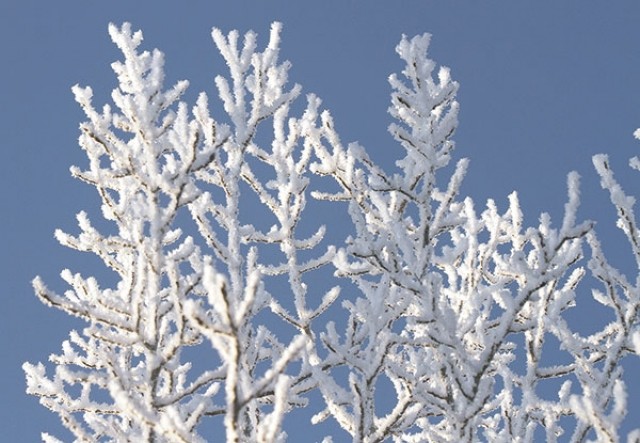
Powell is just now thawing out — almost, anyway — after a record-breaking cold spell.
Arctic air rolled in from the North Pole over Canada and most of the United States Monday, Dec. 2, said Chris Hattings, meteorologist with the National Weather Service in Riverton.
And that Arctic front settled in until Tuesday, Dec. 10. Meteorologist Ralph Estell said Powell records were set four days in a row, Dec. 5-8.
The low on Thursday, Dec. 5, was 15 below, snapping the old record of 13 below on 2011. The thermometer stayed at 15 below on Friday, Dec. 6, breaking the record of 10 below set on 2011.
On Saturday, Dec. 7, it bottomed out at 19 below, 5 degrees colder than the old record of 14 below set in 2005.
The coldest day during this run of frozen weather was Sunday, Dec. 8, when it was 20 below. That was 7 degrees worse than the record of 13 below set in 2005.
The records are based on data from 1981 to 2013, said Jeff Braun, meteorologist with the National Weather Service in Riverton. The all-time low in Powell during that period is 34 below, recorded on Dec. 22, 1990, Braun said.
The cold snap pushed temperatures far below the norm. Mid-30s are typical in Powell in December at least until the Winter Solstice (the shortest day of the year), which arrives on Saturday, Dec. 21, according to meteorologist Trevor LaVoie.
But the worst is past, at least for a bit. Today (Thursday) the high is expected to reach 31 degrees under mostly sunny skies with a low of 17 under partly cloudy skies, according to the NWS.


