Cloudy, 29° F
Winter Storm Cleon may drop a foot or more of snow into higher elevations today (Tuesday) and Wednesday, according to forecasts. That would boost the slumping snow piles in the state. Snowfall in the Powell area is expected to be modest, a few …
This item is available in full to subscribers.
The Powell Tribune has expanded its online content. To continue reading, you will need to either log in to your subscriber account, or purchase a subscription.
If you are a current print subscriber, you can set up a free web account by clicking here.
If you already have a web account, but need to reset it, you can do so by clicking here.
If you would like to purchase a subscription click here.
Please log in to continue |
|
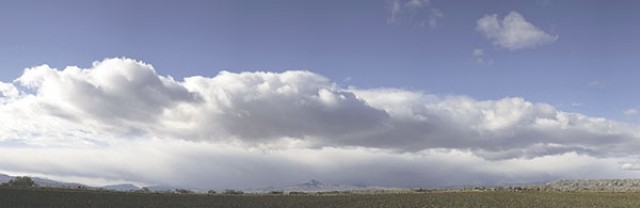
Wyoming’s snowpack is declining, but it is expected to get a big boost this week.
Winter Storm Cleon may drop a foot or more of snow into higher elevations today (Tuesday) and Wednesday, according to forecasts. That would boost the slumping snow piles in the state. Snowfall in the Powell area is expected to be modest, a few inches at most.
But it will be extremely cold, with “highs” in single digits and lows that will hit dangerous levels, with 6 below forecast for the low on Wednesday.
The snowpack averages locally and across state are mostly declining, but remain higher than 2012.
“The SWE (snow water equivalent) is slipping a little as we are down to 131 percent of median,” said Lee Hackleman, water supply specialist for the Natural Resource Conservation Service office in Casper. “We were at 74 percent last year.”
Hackleman is talking about statewide averages.
The Shoshone basin SWE was 134 percent Monday. One week ago it was 131 percent and it was at 98 percent Dec. 2, 2012. The Big Horn basin SWE was 144 percent Monday. One week ago it was 156 percent and was 88 percent Dec. 2, 2012.
Those percentages are based on a 30-year average from the Natural Resource Conservation Service. The upper Bear basin is the lowest this week at 80 percent and the Belle Fourche basin the highest at 238 percent SWE.


